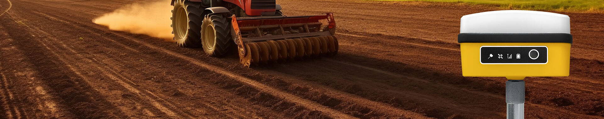
Field navigation systems in precision agriculture are shaped by several core technologies that enhance farm operations. At the heart of these systems are Global Navigation Satellite System (GNSS) receivers, which frequently employ RTK GPS technology for superior accuracy. By utilizing RTK receptors, these systems enhance positioning data through satellite signal corrections, facilitating highly accurate field operations. Integrating precision measurement tools such as sensors and cameras further enriches field navigation by providing real-time data on variables like soil conditions and crop health. These tools enable farmers to respond quickly to field variability, improving overall farm management. Software platforms are equally crucial, as they process the collected data and offer actionable insights, thereby streamlining decision-making processes for better productivity and resource management.
Field navigation systems significantly enhance traditional farming methods by infusing them with precision, thus elevating efficiency and productivity. This innovation streamlines farming workflows, reducing waste and optimizing resource use. By implementing technologies such as RTK GPS, farmers can achieve precise planting, fertilizing, and harvesting, leading to higher crop yields while minimizing input costs. Furthermore, integrating real-time tracking and data analytics tools empowers farmers to make informed decisions that support sustainable agricultural practices. This transformative approach aligns traditional farming methods with modern precision agriculture, ensuring environmentally friendly practices and improved farm efficiency.
RTK (Real-Time Kinematic) technology enhances precision in agricultural tasks by refining GNSS signals, achieving centimeter-level accuracy. This level of precision is not just technical jargon; it significantly impacts practical field applications. Tasks like planting and spraying benefit immensely from this accuracy, owing to the tight overlap and minimized gaps. According to studies, implementing RTK GPS can dramatically reduce errors, optimizing the resource allocation on farmlands. This technology proves indispensable as it ensures that machinery follows precise paths, safeguarding against resource wastage while maximizing efficiency.
Seamless integration of RTK GPS with precision measurement equipment, such as yield monitors and soil sensors, transforms data collection and management in agriculture. By combining these technologies, we create a robust system that maps field variability, enabling tailored operations for specific zones. This synergy doesn’t just sound effective—it is backed by evidence showing improved decision-making and resource allocation. Such enhancements not only boost operational efficiency but also contribute to sustainable agriculture by optimizing every action based on precise data—hence aligning with broader ecological goals.
Field navigation systems are vital for optimizing resource use through spatial precision. They enable the precise application of water, fertilizers, and pesticides, leading to significant cost savings for farmers. By leveraging these technologies, farms can achieve reductions in resource consumption ranging from 10% to 30% compared to traditional methods, as evidenced by various studies. Such effective resource management not only enhances profitability but also promotes sustainable agricultural practices. As farmers adopt these technologies, they find themselves increasingly equipped to manage resources efficiently, thus improving their bottom line.
Reducing environmental impact is a cornerstone of modern agriculture, and targeted applications through field navigation systems play a crucial role. These systems minimize runoff and soil degradation by ensuring that inputs are applied only where needed, supporting long-term sustainability. Evidence supports that improved soil health and biodiversity are major outcomes of implementing these technologies. By making informed decisions on the timing and location for chemical applications, farmers nurture healthier agricultural landscapes, which are resilient over time. As a result, targeted applications contribute significantly to sustainable agricultural practices, allowing farmers to safeguard their ecosystems while maintaining productivity.
The high initial investment cost poses a significant obstacle for small-scale farms in adopting field navigation systems. Financial assistance programs and cooperative models may offer potential solutions to mitigate these challenges. Industry reports markedly suggest that although the adoption of such systems can be financially demanding initially, the eventual long-term savings through improved efficiency and productivity make a compelling case. As farmers see evidence of increased profits and reduced input costs resulting from precision measurement tools, they may be more inclined to embrace the technology. By educating farmers on the financial benefits over time, we can encourage adoption even among smaller operations, ultimately overcoming cost barriers.
The technology gap remains a significant challenge, particularly for farmers in regions with limited access to advanced technologies. Providing necessary training and support is vital for bridging this divide. Collaborative efforts between technology providers and local agricultural organizations can facilitate greater knowledge transfer and encourage adoption. Developing tutorial programs that demonstrate practical benefits of field navigation systems across diverse farming systems can aid in overcoming resistance to new methods. By showcasing real-world examples, such as efficiency in RTK GPS systems, farmers can learn to leverage precision navigation technologies that significantly enhance their farming operations. Through collaboration and targeted educational efforts, we can mitigate the technology gap and promote wider accessibility to precision measurement equipment.
The future of agricultural navigation is being transformed through advancements in autonomous machinery and AI-driven algorithms. These technologies enable real-time adjustments and optimized path planning. This innovation promises enhanced efficiency and a significant reduction in labor costs, with studies suggesting productivity can increase by more than 20% (source: market.us). AI systems can analyze large data sets to predict optimal planting and harvesting times, ensuring minimal operational downtimes. As more farms adopt these high-tech solutions, we can expect a substantial evolution in the farming sector, focusing on precision measurement tools and precision measurement equipment to boost productivity.
Future innovations in field navigation systems focus on offering scalable solutions to meet the diverse needs of farmers, from small operations to extensive agribusinesses. By developing adaptable systems for varied agricultural practices and environmental conditions, technology developers are positioned to support global farmers in sustainably increasing productivity. As research indicates a booming demand for such adaptable systems (source: Statista), these innovations contribute significantly to global food security. From precision measurement tools to high-tech RTK GPS systems, these future solutions promise to cater to every unique farming requirement while addressing the challenges of diverse geographical demographics.


 EN
EN AR
AR NL
NL FR
FR DE
DE HI
HI IT
IT JA
JA KO
KO PT
PT RO
RO RU
RU ES
ES SV
SV TL
TL IW
IW ID
ID VI
VI SQ
SQ TH
TH TR
TR MS
MS IS
IS HY
HY UR
UR BN
BN MN
MN