Getting accurate measurements right on site makes all the difference when building anything from scratch. Precision matters because even small errors can affect worker safety, slow down progress, and eat into budgets. We've seen projects go sideways before where wrong measurements led to wasted concrete, steel shortages, and schedule slips that cost clients thousands. That's why most smart contractors now invest in good quality laser levels and digital mapping tools. These technologies help keep everything aligned with blueprints while saving time during inspections. Project managers rely on them daily to spot discrepancies early before they become expensive problems later down the line.
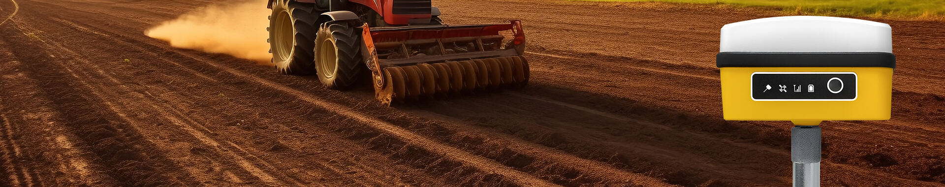
RTK GPS stands for Real Time Kinematic GPS technology, and it's basically what makes getting super precise location information possible through those ground based reference points. Regular GPS just uses satellites floating overhead, but RTK takes things further by setting up these special ground stations we call base stations across different areas. What happens next is pretty neat actually these base stations transmit correction data straight to the mobile devices out there in the field, commonly referred to as rovers. When those rovers receive this information, they can fix their position readings almost instantly. The system corrects all sorts of problems that normally mess with GPS accuracy like weird weather effects messing with signal paths or tiny timing discrepancies between satellites. Because of all this error fixing going on behind the scenes, RTK GPS gets down to measurements accurate within just a few centimeters.
RTK GPS brings a whole new level of accuracy compared to what regular GPS systems offer. Standard GPS might get us within a meter or so, but RTK takes it down to centimeters, which makes all the difference when working on things like building foundations, land surveys, or any kind of engineering work where measurements matter. On actual construction sites, having this kind of precision means workers stay right on spec throughout the whole project. Fewer mistakes happen, there's less wasted concrete and steel lying around, and nobody has to tear out walls they already built. Contractors who've switched to RTK report finishing jobs faster too since everyone knows exactly where everything needs to go without second guessing.
RTK GPS gives measurements down to the centimeter, which helps construction crews stick to those really tight specs they have to follow. When things are this accurate, buildings actually end up matching what was drawn on paper and also pass all the required inspections. No one wants to spend extra money fixing mistakes later, right? Getting positions just right matters a lot when putting together walls, roads, bridges everything needs to line up properly so the whole project works out as intended from day one.
RTK GPS makes it possible to collect data as things happen, which really helps with making decisions faster and cutting down on those annoying project delays we all hate. When something goes wrong during monitoring, crews can fix problems right away instead of waiting days for someone to come back out. This instant access to accurate information cuts down on how often workers have to drive back and forth to sites just to check measurements again. Sure, there are still some situations where multiple visits make sense, but overall most projects see better results when teams can work from current data rather than outdated reports.
The numbers don't lie when it comes to RTK GPS making construction work better and fewer mistakes than old school methods. Take a look at real world data from construction sites where teams started using RTK GPS technology. Error rates dropped around 15% or so according to industry reports, which means fewer delays and getting those important project checkpoints hit on time. What makes this tech so valuable? Well, the increased precision cuts down on wasted materials and rework, while workers spend less time double checking measurements. Project managers notice these improvements across multiple aspects of their operations, ultimately resulting in higher quality finished structures that meet specifications right out of the gate.
Construction professionals have increasingly turned to RTK GPS technology for their site surveying needs over recent years. The system provides incredibly precise measurements down to the centimeter, which makes all the difference when figuring out property lines, mapping terrain changes, and setting up building foundations. With such accuracy at their fingertips, contractors avoid those frustrating situations where mistakes in initial surveys end up causing major headaches later on. We've seen projects saved from expensive setbacks simply because the team had reliable data from day one instead of guessing based on old maps or estimates.
RTK GPS systems are really important when it comes to tracking how structures move during construction work. Safety regulations require this kind of monitoring across the entire building process. The real time data these systems provide lets us spot any unexpected shifts or settling in foundations before they become serious problems. Engineers can then decide if extra support is needed or if adjustments must be made to prevent future issues. We've seen this firsthand on several major projects recently. For instance, when working on skyscrapers or bridges built over land with shaky ground conditions, having accurate movement readings makes all the difference between a stable structure and one that might fail down the road.
RTK GPS has found its way into many different projects across industries, proving itself both versatile and effective. Take major construction sites for example road building efforts or city expansion projects where contractors rely heavily on this technology day after day. The real time information provided by RTK GPS systems lets teams make faster decisions on site without waiting for delayed reports. This speeds things up considerably during complex earthworks or alignment tasks. Most importantly, better coordination between different parts of a project means fewer mistakes and ultimately saves money while keeping deadlines intact.
RTK GPS tech has proven itself incredibly useful on all sorts of construction jobs, whether working in busy city centers or out in isolated locations. What sets it apart is its ability to deliver pinpoint accuracy down to the centimeter level something that matters a lot when making precise measurements on site. Because of how flexible this system is, contractors find it works well for multiple applications. We're talking foundation work, getting buildings aligned properly, tracking project progress over time everything needed to make sure specs get followed correctly throughout the entire construction process.
RTK GPS works really well when paired with other tech stuff like drones and BIM systems, making it even more useful for construction projects. Teams using RTK GPS alongside drones get to do aerial site surveys much faster than traditional methods allow. They can cover big areas in no time while still getting accurate measurements down to centimeters. The BIM integration is pretty cool too. When RTK GPS data gets fed into these building models, everything stays updated in real time. Contractors actually see changes happening on site reflected immediately in their plans, which helps them coordinate better across different parts of the job. All these tech combinations cut down on mistakes during construction and save money in the long run because nobody has to redo work caused by measurement errors.
RTK GPS also helps teams work together better because it makes technology integration so straightforward. When accurate real time information is just there for everyone to see, people like architects working alongside site managers can actually make good decisions fast instead of waiting around. The whole workplace becomes more cooperative when everyone has access to the same numbers. No one is guessing anymore since they're all looking at identical data points. Projects tend to go smoother too since mistakes happen less often and nobody gets confused about what's going on.
Selecting the right RTK GPS product is essential for optimizing construction applications. Here are three top products to consider:
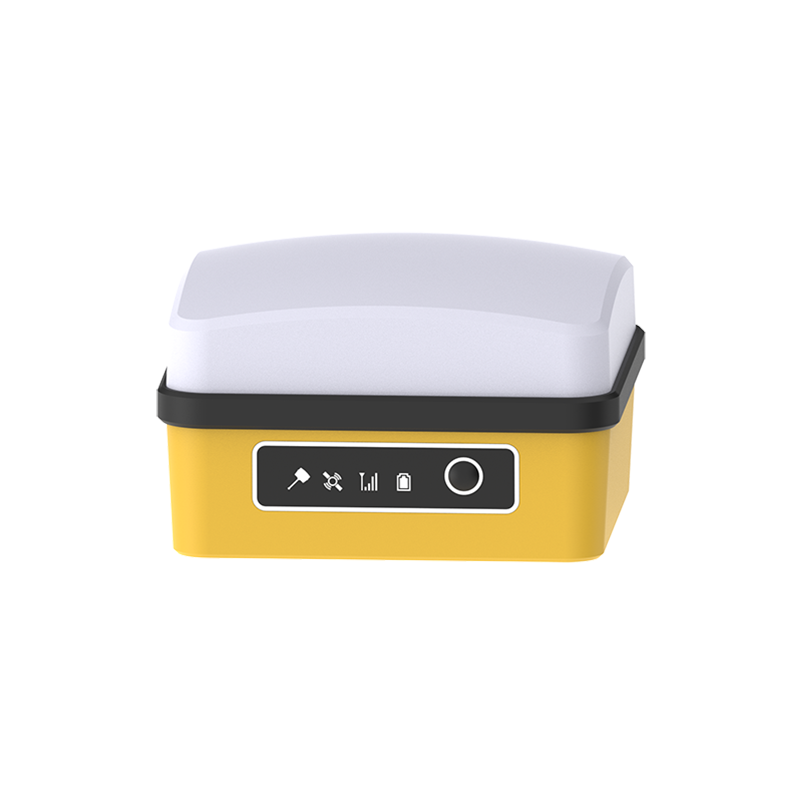
The Cube RTK Small Volume Full System serves as an RTK satellite locator with pretty comprehensive capabilities across different construction sites. What makes this device stand out? Well, it handles multi-frequency positioning while packing in handy connectivity options such as 4G, Wi-Fi, and Bluetooth right into the unit itself. No need to worry about losing connection on site. And let's talk about practical stuff too. The 32GB storage space means plenty of room for all those survey points and measurements. Plus, with battery life stretching up to around 15 hours, workers can actually get through a full day without constantly hunting down power outlets. Makes sense when considering how much time gets spent outdoors at construction locations.
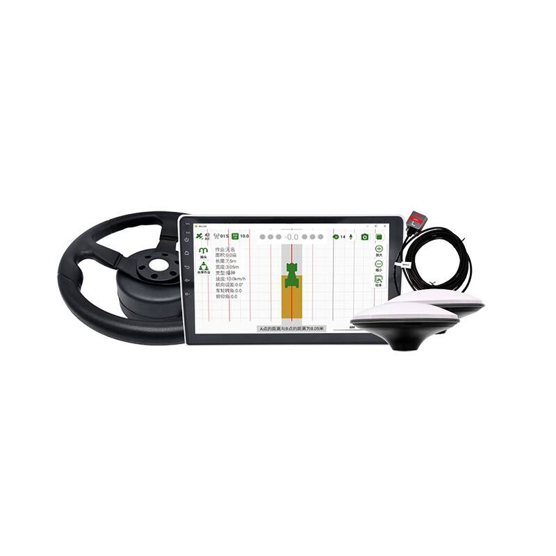
Originally meant for farm equipment, the GPS Tractor Auto Steering System has found its way into construction sites too thanks to how automated and accurate it is. At the heart of this tech sits a super precise Beidou satellite chip that gets within about 2.5 centimeters accuracy most of the time. Installation isn't complicated at all, and once set up, operators find the controls pretty straightforward. What makes this system stand out is that it works across different speeds and can handle multiple operation settings depending on what the job requires. Farmers love it for their fields, but contractors have started adopting it as well for similar reasons.
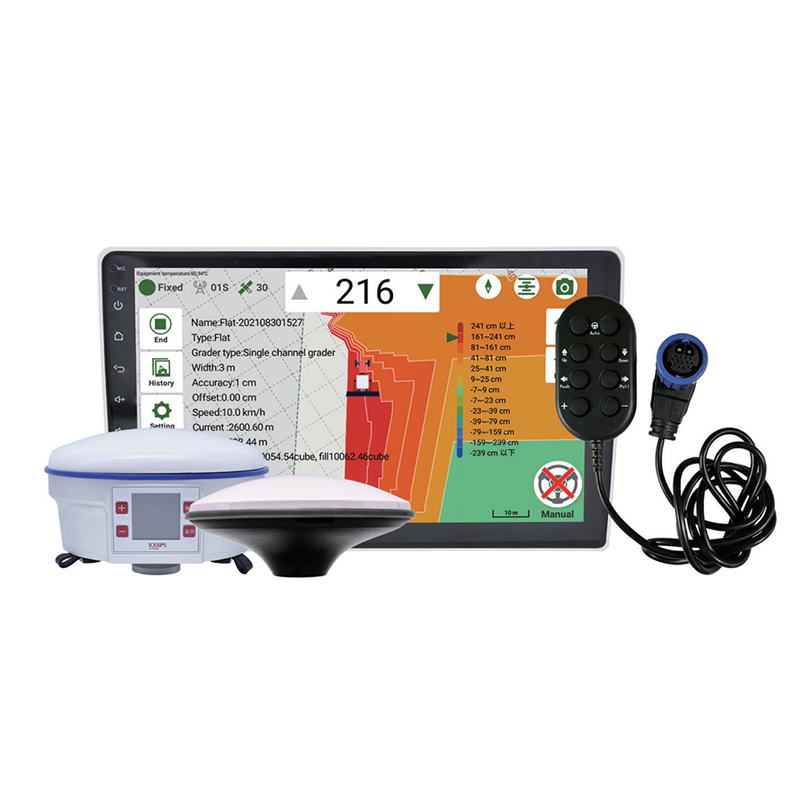
The RTK Grader Leveling System provides a streamlined solution for land leveling and grading. Utilizing Android-based interface technology, this system allows for easy user interaction and precise control. It measures and calculates land height automatically, optimizing efficiency and accuracy for construction tasks that involve detailed land shaping.
These RTK GPS products not only enhance precision in construction applications but also significantly improve productivity and operational efficiency.
RTK GPS tech definitely delivers impressive accuracy, but it does have some drawbacks worth mentioning. The biggest issue? Signal problems when there are obstacles around like tall buildings or thick trees blocking the view between GPS devices and satellites. This happens quite often actually, especially in urban areas where concrete jungle meets satellite signals. Another catch is that these systems need to stay reasonably close to base stations to work properly. That means setting up a reliable link between equipment and base stations becomes essential. But let's face it, finding good spots for those base stations isn't always possible depending on terrain or remote working conditions.
Getting the most out of RTK GPS requires following some basic guidelines that many experienced operators know well. Regular calibration checks are essential for keeping position readings accurate over time. The GPS unit needs a good view of the sky too since trees, buildings, or even heavy cloud cover can mess with signal strength and make coordinates less reliable. Don't forget about the base station connection either it needs solid reception throughout the day to keep transmitting correction data without interruptions. A weak link here means poor results on site.
Many practitioners in the field have found success when they combine these systems with other supporting technologies and carefully select where installations take place. Putting several base stations throughout the work area tends to give better signal coverage and makes things more reliable overall. Most experienced technicians also point out that implementing sophisticated error correction methods really helps, along with looking at options for mobile or portable base stations which can be moved around as needed for different job sites. When all these factors get proper attention during setup, most operators report significantly improved performance from their RTK GPS equipment in real world conditions.
RTK GPS tech has become a game changer in construction because it delivers such incredible accuracy and saves time on job sites. Contractors can measure land features precisely and get instant corrections while working, which cuts down errors and rework across most construction projects. Looking at how things are going in the industry right now, RTK GPS isn't just staying relevant it's actually becoming more critical as builders adopt automated machinery and integrate these systems into their smart construction workflows. Many forward thinking companies are already seeing benefits from this technology beyond basic surveying tasks.
The future looks bright for those working on site when they start using RTK GPS systems for their work. These devices boost accuracy significantly while cutting down money lost from mistakes and having to fix things twice. Construction workers and engineers find this tech particularly helpful because it saves time and resources across multiple job sites. When teams actually implement RTK GPS into their daily operations, they tend to handle complex construction requirements much better than before. The confidence boost alone makes all the difference in meeting tight deadlines without compromising quality standards.


 EN
EN AR
AR NL
NL FR
FR DE
DE HI
HI IT
IT JA
JA KO
KO PT
PT RO
RO RU
RU ES
ES SV
SV TL
TL IW
IW ID
ID VI
VI SQ
SQ TH
TH TR
TR MS
MS IS
IS HY
HY UR
UR BN
BN MN
MN