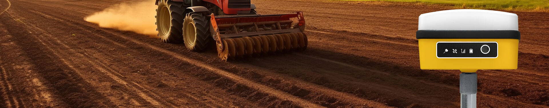
RTK (Real-Time Kinematic) GPS is a cutting-edge satellite navigation technique that significantly enhances the precision of position data, offering a remarkable upgrade over traditional GPS systems. Unlike conventional GPS, which typically provides accuracy within 5 to 10 meters, RTK GPS delivers position accuracy at the centimeter level. This improved precision is achieved through a network of reference stations that supply correction data collected from satellites, minimizing positioning errors effectively. RTK GPS is instrumental in various applications that require high precision, such as agriculture, construction, and geospatial surveying. For example, in precision farming, RTK GPS allows for exact alignment and planting, improving resource efficiency and crop yield, while in construction, it ensures accurate excavation and foundation placement.
Portable RTK systems are comprised of two essential components: base stations and rovers. The base station is responsible for receiving satellite signals and computing corrections necessary to mitigate positioning errors caused by atmospheric and other external factors. These corrections are transmitted to the roving units, which utilize them to determine their exact location in real-time. This seamless integration allows operators to make immediate adjustments based on highly accurate data, enhancing field efficiency by significantly reducing the time spent on positioning tasks. The ability to rely on precise data enables us to streamline operations, such as surveying large areas or coordinating construction machinery, thereby optimizing productivity and ensuring consistent project outcomes.
One of the primary advantages of using Portable RTK Systems is their ability to provide real-time corrections that lead to superior accuracy. Geospatial World reports that these systems can achieve positional accuracies as precise as 2.5 centimeters, a significant enhancement over traditional GPS methods. This level of accuracy is crucial for operations requiring exact measurements, such as in land surveying and construction layout. In these domains, centimeter-level precision means reduced errors, enhanced efficiency, and significant time savings in project completion.
Real-Time Kinematic technology revolutionizes workflows by allowing for immediate data processing and visualization of results. By providing teams with real-time insights, RTK systems enable faster decision-making and increased productivity. The integration of real-time data with Geographic Information System (GIS) applications further enhances decision-making processes, allowing professionals in fields like agriculture, construction, and geospatial surveying to make informed decisions without the delay associated with data post-processing. This seamless data stream and enhanced integration lead to more streamlined workflows and improved operational efficiencies.
RTK receptors are fundamental components in the processing of satellite signals, and they play a critical role in ensuring accurate and efficient signal interpretation. These receptors utilize sophisticated algorithms for noise reduction, which significantly enhances the precision of the data received. By doing so, RTK receptors are capable of providing reliable real-time kinematic (RTK) data crucial for applications requiring high accuracy such as land surveying and construction. Furthermore, selecting RTK receptors that support multiple Global Navigation Satellite System (GNSS) signals is essential. This capability enhances both signal reception and reliability, particularly in challenging environments where signal obstruction is a common issue. Understanding what RTK GPS is and how these receptors function can greatly optimize their use in various applications.
Portability in RTK systems is largely due to designs that emphasize being lightweight yet durable, making them tailor-made for field conditions. These portable RTK systems are engineered to be easily transported and set up across diverse environments, thanks to their compact and robust design. A critical aspect of these systems is their weather-resistance, allowing them to operate continuously even in harsh outdoor conditions. Manufacturers often employ advanced materials and innovative engineering techniques to enhance both the strength and the portability of these devices. This ensures that field operators can rely on these systems for consistent performance without the burden of cumbersome equipment. As a result, the application of RTK GPS technology in demanding environments becomes more efficient, enhancing productivity and accuracy in field operations.
When selecting a portable RTK system, it's crucial to assess the level of accuracy needed for your specific applications. Depending on the industry, the required precision can vary significantly. For instance, applications such as precision agriculture or civil engineering often demand centimeter-level precision, achievable only with high-quality RTK systems. Such precision helps ensure tasks like crop mapping or construction layout are executed flawlessly. Thus, potential users should carefully evaluate their operational needs to choose a system that aligns with their accuracy requirements, ensuring they can meet the standards of their industry effectively.
Compatibility with existing technologies is essential for seamless integration and maximizing operational efficiency. When considering a portable RTK system, determining its compatibility with current GNSS infrastructure can facilitate smooth operations. Additionally, systems that support SLAM (Simultaneous Localization and Mapping) are increasingly valuable, especially for indoor mapping applications where traditional satellite signals may be unavailable. Ensuring that the RTK system is compatible allows users to leverage their existing technology investments, reducing redundancy and costs. Making an informed choice leads to enhanced capability without unnecessary complexities, providing a balanced approach to system integration.
The integration of RTK technology with SLAM LiDAR systems signals a new era in mapping capabilities. This fusion addresses the challenges of traditional mapping by enabling precise and efficient data capture across diverse environments. Combining RTK with SLAM LiDAR allows for seamless indoor-outdoor mapping, significantly enhancing the accuracy of spatial data collection where GNSS signals are often compromised. As our industries increasingly demand versatile mapping solutions, the integration of these technologies remains at the forefront, pushing the boundaries of geospatial tech. This is particularly relevant as industries progress towards the adoption of multifaceted mapping systems, underscoring the future developments in geospatial technology.
Anticipated advancements in RTK receptors are set to redefine sensitivity and power efficiency. Today's RTK receptors are evolving to enhance their sensitivity, ensuring more reliable signal acquisition even in environments with limited satellite visibility. This improvement is crucial for maintaining centimeter-level accuracy in challenging locales, such as urban canyons or dense forest canopies. Simultaneously, the focus on energy-efficient designs extends the battery life and operational usability of portable RTK systems, facilitating extended field operations without frequent recharging. These advancements not only enhance performance but also align with the growing need for sustainable and efficient technological solutions in geospatial applications.


 EN
EN AR
AR NL
NL FR
FR DE
DE HI
HI IT
IT JA
JA KO
KO PT
PT RO
RO RU
RU ES
ES SV
SV TL
TL IW
IW ID
ID VI
VI SQ
SQ TH
TH TR
TR MS
MS IS
IS HY
HY UR
UR BN
BN MN
MN