Global Navigation Satellite Systems (GNSS) are a network of satellites that provide precise location data across the globe, revolutionizing the field of land surveying. GNSS utilizes a constellation of satellites that transmit signals to ground receivers, enabling surveyors to determine exact positions with remarkable precision. This technology has drastically improved the efficiency and accuracy of land surveying practices, transition from traditional theodolites and chains to advanced satellite-based measurements.
The evolution of GNSS technology has significantly transformed land surveying. Historically, surveyors relied on manual methods that were time-consuming and prone to errors. However, with advancements in GNSS, the reliance on these traditional methods has decreased, paving the way for more precise and efficient satellite-based measurements. This shift has streamlined processes and enhanced the precision of measurements, while also reducing the time required to complete surveying tasks.
There are numerous benefits of using GNSS in land surveying, which include increased accuracy, time efficiency, and enhanced data collection capabilities. The technology provides superior precision, often down to a few centimeters, and allows for the collection of large datasets in real-time. This not only aids in improving project planning and execution but also reduces the time spent in the field. For example, precision measurement tools, such as RTK GPS, offer real-time correction data that ensures high accuracy in varying conditions.
A growing body of evidence underscores the vital role GNSS plays in improving measurement precision and efficiency in surveying. According to reports from surveying associations, the adoption of GNSS technology has led to significant advancements in measurement accuracy and efficiency rates. These improvements are crucial in addressing the increasing demands of modern infrastructure, agriculture, and other industries reliant on precise land surveying data. As GNSS technology continues to evolve, it will undoubtedly propel the land surveying industry towards even greater precision and efficiency.
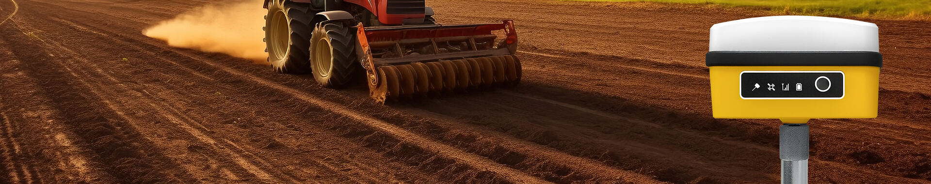
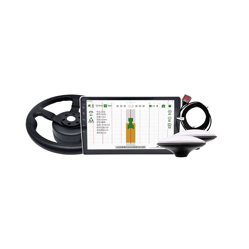
The integration of advanced GNSS technology with innovative tools like the GPS Tractor Auto Steering System has revolutionized precision farming. This system employs a high-precision Beidou satellite positioning chip to provide 2.5cm accuracy, making it a game-changer for agricultural machinery like tractors and harvesters. Its user-friendly interface and support for various working environments enhance operational efficiency. Users can monitor equipment status in real-time via an app and adapt to different conditions using the system's day and night modes. This makes it an essential tool for farmers aiming to maximize their crop yield and streamline farm operations.
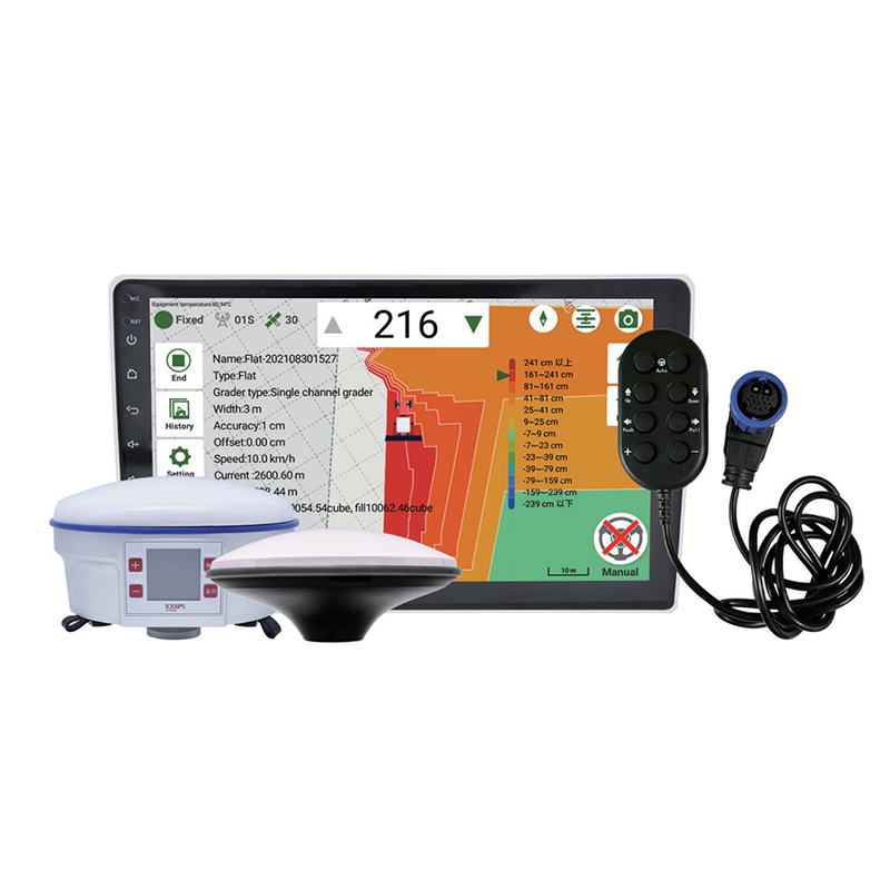
The RTK Grader Leveling System represents another innovative leap in land surveying, particularly beneficial for agricultural land leveling. By offering precision measurements with a 10” Android interface, this system ensures high accuracy without the need for a base station. This functionality aids in efficiently setting plane height, which is essential in varied construction projects. Its capability to connect with multiple network differential systems and provide real-time monitoring further enhances its utility, offering a significant advantage in achieving consistency and reliability in land development.
These equipment advancements demonstrate the synergy between cutting-edge GNSS systems and innovative land surveying tools. By leveraging technologies like RTK GPS and precision measurement tools, they not only improve operational efficiency but also significantly enhance measurement accuracy. This illustrates a broader trend in GNSS technology, where integration with advanced hardware increases productivity and data precision across various sectors, from agriculture to construction. This evolution is crucial for meeting the growing demands for precision and reliability in modern surveying practices.
The application of GNSS technology in construction and infrastructure development has significantly improved efficiency and project delivery timelines. By delivering precise data for site analysis and layout planning, GNSS has streamlined construction processes. For instance, projects like highway developments and urban transit systems have utilized GNSS to minimize survey time and costs, as highlighted by case studies. This integration into construction has not only fast-tracked project timelines but has also enhanced the precision and safety of operations.
In precision agriculture, GNSS technology plays a pivotal role in crop monitoring, land management, and yield optimization. By utilizing RTK GPS systems, farmers can accurately map fields, monitor crop health, and apply inputs more precisely, which leads to better land use and increased yield. This results in more efficient agricultural practices and sustainable farming by reducing wastage and enhancing productivity through precise measurement tools and techniques.
Moreover, advancements in GNSS technology contribute significantly to environmental monitoring efforts. These include tracking changes in land use, managing natural resources, and responding to disasters. By providing real-time data and accurate geolocation, GNSS enables authorities to quickly assess environmental changes and manage natural resources effectively. In disaster response, GNSS helps in monitoring and coordinating efforts, ensuring timely and efficient resource deployment. Thus, GNSS has become indispensable in managing and protecting our environment.
GNSS systems face significant challenges, particularly due to signal obstruction and accuracy issues in urban environments. Buildings, trees, and other structures can interfere with GNSS signals, leading to reduced accuracy and reliability. Urban canyons, created by tall buildings, are notorious for reflecting GNSS signals, thus complicating precise location determinations which are crucial for applications such as precision measurement and rtk gps. This limitation necessitates continued research and development to enhance GNSS technology's robustness.
Expanding educational resources and training programs is vital to ensure that professionals can proficiently use GNSS technologies. As GNSS technology evolves, surveyors and related professionals must keep pace with technical advancements. Developing comprehensive training initiatives can bridge the knowledge gap and provide a foundation for understanding new tools that integrate GNSS with additional precision measurement technology. This approach not only enhances current surveying practices but also prepares professionals for future innovations.
The integration of GNSS with emerging technologies like drones and the Internet of Things (IoT) represents a promising direction for expanding surveying capabilities. By combining GNSS with these technologies, surveying applications can be broadened to include more automated and efficient land analysis and data collection. For instance, drones equipped with GNSS can conduct large-scale land surveys quickly and with high precision, while IoT devices can offer real-time data collection for improved agricultural machinery management and environmental monitoring. This convergence points to a future where surveying becomes more adaptive and expansive in its applications, catering to diverse industry needs.


 EN
EN AR
AR NL
NL FR
FR DE
DE HI
HI IT
IT JA
JA KO
KO PT
PT RO
RO RU
RU ES
ES SV
SV TL
TL IW
IW ID
ID VI
VI SQ
SQ TH
TH TR
TR MS
MS IS
IS HY
HY UR
UR BN
BN MN
MN